Aug 20, 2009

Hunza Blossom


Spring being the beginning of season usually from early April welcome you to the Northern Areas. Hunza & Nagar in Bloosom present an aesthetic panorama. The lush green tarraced fields surrouded by blooming trees and the village itself guarded by snowbound sky kissing mountains displaying scene enough to overwhelms visiters. Moreover, besides the appealing vistas, the fragrance emanating in the villages add charm to the visual beauty. This breathtaking tour in beautiful spring in the north gives you the huge variety of natural splendors. This panorama can be seen throughout in the North along the KKH and off the road.
Start it from Gilgit, the capital of Northern Areas. When you arrive in Gilgit you will feel that you are somewhere you need to be in Spring. Bagrot valley in Gilgit is at around an hour drive famous for its panoramic outlook in spring and summer. Kargah Buddah in the tiny Kargah valley is about 30 min drive from the city. It is more famous for the carved Buddha in a rock about 12 meters from the pathway.
Proceed further to Hunza. Karimabad is about 95 km from Hunza and usually takes 3 hours but with repeated cessations on the viewpoints could prolong the journey double as longer up to Hunza. You will stay in Hunza even if you never liked to do that. Drive further to upper Hunza for added beauty, hit the Khunjarab Pass (The highest border linking China and Pakistan at an elevation of 4757m) and start the journey back. You can spare a day to visit Nagar valley off the KKH opposit Hunza valley. You can drive up to the Hoper Glacier flowing down by the valley with picturesque mountains in the surroundings

Aug 19, 2009

Silk Route


For centuries, the ancient Silk Route was one of the land links connecting Northern Areas with the outside world; the armies of Alexender the Great, the early pilgrims taking Buddhism to China, caravans of spiece and silk traders, and mysterious explorers-cum-spies playing out the "Great Game" of imperial rivalry between the Russian and British empires have all trodden this path.
All these people who explored the adventure of this route brought new ideas and influences instrumental in shaping the way people think and see. The sluggish Process of change in Northern Areas, due to remoteness, suddenly speeded up with conversion of this historic path into Karakoram Highway (KKH) in early 1979?s.
Initially KKH, connecting Pakistan with China spurred feeling of openness, connectivity, hope and business opportunities. However, true potential of KKH as a means to uplift the socio-economic conditions of the broader NA society has yet to be realized.
For its sheer mountain grandeur and beauty, few places can match the landscape through which Karakoram Highway passes. A fantastic spectacle is the passage of the highway along the Batura glacier, rated among the world?s seven largest. The Khunjarab pass, which the Highway crosses, and the nearby Mintaka pass lies on the ancient Silk Route connecting Europe with Asia.
The 809 kms (570miles) black-top Karakoram Highway, great marvel modern engineering, links the northern region of Pakistan with Chinese Province Xinjiang. The highway follows the ancient Silk Route that was used by Chinese traders during the rule of Han Dynasty 2,100 years ago. There has always been a steady flow of visitors, scholars and traders through this route. Famous scholars like FaHian, Huen Tsang and travellars like Marcopolo also used this route. A brisk trade of tea, silk and porcelain from China and Gold, Ivory, jewels and spices from the India-Pakistan subcontinent flourished almost 2,000 years ago. Where the ancient trade caravans took months to cross the mountains, the same distance can now be covered in hours over an all-weather metalled road.
Karakoram Highway took about twenty years to complete. The 775 kms long Highway was hacked through the world?s toughest terrain. It involved the service of 15,000 men of Pakistan Army and Chinese workers. During the course of construction more than 900 workers both from China and Pakistan laid their lives. Their memorial can be seen near Nomal and at Danyore. The road between Shatial and Chilas is particularly interesting as on its stretch ancient rock-carvings and etchings can be seen which date back to the Buddhist times.

Polo in Northern Areas


The game Polo
(chaugan) described as “the game hockey played on horse back, polo being properly in the language of that region” the ball used in the game (yale and burnell on p.719). in the article on chicane and chicanery which as words are traceable to the game chaugan or horse- golf, polo is a game looked upon as hockey-on horse back while just above it is conceived as golf on horse back. However hockey is much faster game than golf. While deriving the word chicane from chaugan the problem has been created as to how chicanery can be associated with polo. This requires dealing with the evolution of the game which will be discussed after the etymology of chugan has been explained.
With regard to its etymology, a probable origin of chaugan would be an Indian, prakrit, word meaning four corners. Plats (in Urdu English dictionary) give this word as chugana, four-fold the name of the polo ground. This means that the game was invented in India where it was named after the playground. There is however another theory, which takes polo to Persia. The concise Oxford English dictionary while explaining the word chicane, states that in Greek polo is called tzoukanaiza which has been derived from the Persian word chaugan, meaning polo stick. Thus chaugan is a persain game and as word means polo. C .diem (p.126) has written a whole book on polo. He refers to and attempts showing that in Pehlavi polo chauvigan or chopgan. The latter word would be a variant of chobgan in which chob-stick but nevertheless would remain unknown.
However according to Diem, and to the Oxford English dictionary, (chaugan) has been the name in Balti, is for polo which makes it the ball game. The discrepancy is obvious. Coming to chicane it is a degenerated form of the word from which chaugan itself is derived. Diem transltes the Greek word for chaugan as tzykanion meaning polo and derives chicane from it. He writes that the Byzantine emperor, Theodosius 2 played polo at Constantinople about 401 A.D. Much earlier it was played in ancient Iran during the time of Darius, 522-486 B.C.
During the reign of king Khusrou Parvez 2 even his queen and her ladies played the game. Summarizing what has been discussed so far polo is an Indian game and the word chaugana four cornered has been modified as chaugan. Polo then was named after the polo ground. Another theory makes polo a Persian game with chaugan derived from chobagan, chob being the polo-stick, but Gan is left unexplained. At any rate as Persian word chaugan would be polo stick.
Diam gives following terms in Chinese. Ball (chiu), chhiu himself translated with an aspirated, polo-stick chhiu-chang.
The evolution of the game polo indicating the country of its birth, Polo has been rightly described by Yule and burn ell as hockey on horse back hence horse comes first to be considered. If we can conceive “Aspasthan” in Persian or horse land it would be magnolia. The Mongols have been nomads and being always on the move most of their time was spent on horseback. In Mongolia the horse was the unit of wealth. So, Mongol pick up lambs to provide more tasty (as booty) meet while the horse was still in full speed, because it is a small horse called pony. It was a dexterous performance which only the Mongols could claim to their credit.

Jul 25, 2009

The Hunza


The Hunza Valley located at 8,100' in northern Pakistan is the home of the longest lived people on the planet. The high mountain valley is surrounded by the Himalayan mountains with the mountain in the photo to the left rising to 25,556'. Northern Pakistan is blessed with the greatest mass of high mountains on earth where the Himalaya, Karakoram, Pamir's, and Hindukush all meet!

As much as the valley is famous for its beauty, the people of Hunza are noted for their friendliness and hospitality. The local language is Brushuski but most people understand Urdu and English. The literacy rate of the Hunza valley is believed to be above 89%, virtually every child of the new generation studies up to at least high school. Many pursue higher studies from prestigious colleges and Universities of Pakistan and abroad.

The Hunza People are uniquely healthy and free of disease. Many studies have been done and it is believed that their simple healthy diet of carefully grown organic food and the glacial, living water is their secret to health and long life. Hunza drink directly from glacial streams in the high Himalayas. It is fresh, invigorating, life enhancing, free radical scavenging and delicious.

The Hunza have the longest lifespan in the world and this has been traced as related to the water that they drink and their natural diet. Hunza water is an example of perfect natural water. Hunza has people who routinely live to 100-120 years, in good health with virtually no cancer, degenerative disease, dental caries or bone decay. Hunza people remain robust and strong and are also able to bear children even in old age. Research has proven conclusively that the major common denominator of the healthy long-living people is their local water.

Apricots Are Hunza Gold


Apricots Are Hunza Gold

Of all their organically-grown food, perhaps their favorite, and one of their dietary mainstays, is the apricot. Apricot orchards are seen everywhere in Hunza, and a family's economic stability is measured by the number of trees they have under cultivation.

They eat their apricots fresh in season, and dry a great deal more in the sun for eating throughout the long cold winter. They puree the dried apricots and mix them with snow to make ice cream. Like their apricot jam, this ice cream needs no sugar because the apricots are so sweet naturally.

But that is only the beginning. The Hunzas cut the pits from the fruits, crack them, and remove the almond-like nuts. The women hand grind these kernels with stone mortars, then squeeze the meal between a hand stone and a flat rock to express the oil. The oil is used in cooking, for fuel, as a salad dressing on fresh garden greens, and even as a facial lotion ( Renee Taylor says Hunza women have beautiful complexions).

The Style For Longer and Better Life

Besides apricots, the Hunzas also grow and enjoy apples, pears, peaches, mulberries, black and red cherries, and grapes. From these fruits, the Hunzas get all the vitamin C they need, as well as the other nutritional richness of fresh fruit, including energy from the fruit sugars. From the grapes, they also make a light red wine that helps make their simple fare into more of a real "meal". Observe the apricots drying in the sun in the photo to the left.

Jul 21, 2009

Daily Physical Exercise


Another great Hunza health secret concerns the considerable amount of time each day devoted to physical exercise. Most exercise is done outdoors in order to take advantage of the pure mountain air, which in itself has a beneficial effect on health.

Although a large part of their day is spent outdoors, working the fields, the Hunzas do a lot more than that. For one thing, they take regular walks - a 15 or 20 kilometer hike is considered quite normal. Of course they don’t walk that distance every day, but doing so does not require any special effort. You should also keep in mind that hiking along mountain trails is a lot more demanding than walking over flat terrain.

Of course we’re not suggesting that you move to the mountains and become a farmer! You don’t have to change your way of life completely in order to stay healthy and live longer. But one thing the Hunza life-style does prove is that exercise is very important for health.

Walking for an hour each day, something most people can manage, is excellent for both your body and your mind. In fact, walking is the simplest, least costly and most accessible form of exercise there is. And contrary to what you may think, it also provides you with a complete workout. So get in step with the Hunzas and start walking

Jul 14, 2009

Burusho


Burushaski (Urdu: بروشسکی - burū́šaskī) is a language isolate (that is, not known to be related to any other language of the world).[1] It is spoken by some 87,000 (as of 2000) Burusho people in the Hunza, Nagar, Yasin, and parts of the Gilgit valleys in the Northern Areas in Pakistan. Other names for the language are Kanjut (Kunjoot), Werchikwār, Boorishki, Brushas (Brushias) and Miśa:ski.

Today Burushaski contains numerous loanwords from Urdu (including English and Sanskrit words received via Urdu), and from neighbouring Dardic languages such as Khowar and Shina, as well as a few from Turkic languages and from the neighboring Sino-Tibetan language Balti, but the original vocabulary remains largely intact. The Dardic languages also contain large numbers of loanwords from Burushaski.

There are three divergent dialects, named after the main valleys: Hunza, Nagar, and Yasin (also called Werchikwār). The dialect of Yasin is thought to be the least affected by contact with neighboring languages and is generally less similar to the other two than those are to each other; nevertheless all three dialects are mutually intelligible.

Relationships

No connection has been established between Burushaski and any other language or language family. Several attempts have been made to establish a genealogic relationship between Burushaski and the Caucasic languages,[2] with the Yeniseian languages in a family called Karasuk,[3] or to include Burushaski in the Dené-Caucasian proposal, which includes both Caucasic and Yeniseian.[4][5] An attempt to link Burushaski to the poorly attested Paleo-Balkan languages has also been made.[6] None of these efforts have met with scholarly acceptance. In 2008 Yeniseian was convincingly shown to be related to Na-Dene in a Dene-Yeniseian family,[7] and the evidence does not appear to extend to Burushaski.

Following Berger (1956), the American Heritage dictionaries suggested that the word *abel (apple), the only name for a fruit (tree) reconstructed for Proto-Indo-European, may have been borrowed from a language ancestral to Burushaski. (Today "apple" and "apple tree" are /balt/ in Burushaski.) Others, however, reconstruct the Proto-Indo-European word for "apple (tree)" as *mel-, while yet others don't think Proto-Indo-European had a word for "apple" at all and consider the different words of different Indo-European subgroups to be separate loans from different unidentified non-Indo-European languages.

[edit] Writing system

Usually Burushaski is not written. Occasionally, the Urdu version of the Arabic alphabet is used, but a fixed orthography does not exist. Nasir al-Din Nasir Hunzai has written poetry in Burushaski using the Urdu alphabet.

Tibetan sources record a Bru-śa language of the Gilgit valley, which appears to have been Burushaski. The Bru-śa are credited with bringing the Bön religion to the Zhangzhung in Tibet and Central Asia, and their script is alleged to have been the ancestor of the Tibetan alphabet. Thus Burushaski may once have been a significant literary language. However, no Bru-śa manuscripts are known to have survived.[8]

Linguists working on Burushaski use various makeshift transcriptions based on the Latin alphabet, most commonly that by Berger (see below), in their publications. The Burushaski Research Academy, in cooperation with Karachi University, has recently published the first volume (A to C̣) of a Burushaski-Urdu Dictionary using this transcription.

[edit] Phonology

Burushaski primarily has five vowels, /i e a o u/. Various contractions result in long vowels; stressed vowels (marked with acute accents in Berger's transcription) tend to be longer and less "open" than unstressed ones ([i e a o u] as opposed to [ɪ ɛ ʌ ɔ ʊ]). Long vowels also occur in loans and in a few onomatopoeic words (Grune 1998). All vowels have nasal counterparts in Hunza (in some expressive words) and in Nager (also in proper names and a few other words).

In addition, Berger (1998) finds the following consonants to be phonemic, shown below in his transcription and in the IPA:
Bilabial Dental Alveolo-
palatal Retroflex Velar Uvular Glottal
Nasal m /m/ n /n/ ṅ /ŋ/
Plosive aspirated ph /pʰ/1 th /tʰ/ ṭh /ʈʰ/ kh /kʰ/ qh /qʰ/2
plain p /p/ t /t/ ṭ /ʈ/ k /k/ q /q/
voiced b /b/ d /d/ ḍ /ɖ/ g /g/
Affricate aspirated3 ch /t͡sʰ/ ćh /t͡ɕʰ/ c̣h /ʈ͡ʂʰ/
plain c /t͡s/ ć /t͡ɕ/ c̣ /ʈ͡ʂ/
voiced j /d͡ʑ/4 j̣ /ɖ͡ʐ/5
Fricative voiceless s /s/ ś /ɕ/ ṣ /ʂ/ h /h/
voiced z /z/ ġ /ʁ/
Trill r /r/
Approximant l /l/ y [j]6 ỵ /ɻ/7 w [w]6

Notes:

1. Pronunciation varies: [pʰ] ~ [p͡f] ~ [f].
2. Pronunciation varies: [qʰ] ~ [q͡χ] ~ [χ].
3. The Yasin dialect lacks aspirated affricates and uses the plain ones instead.
4. Sometimes pronounced [ʑ].
5. Sometimes pronounced [ʐ].
6. Berger (1998) regards [w] and [j] as allophones of /u/ and /i/ that occur in front of stressed vowels.
7. This phoneme has various pronunciations, all of which are rare sounds cross-linguistically. Descriptions include: "a voiced retroflex sibilant with simultaneous dorso-palatal narrowing" (apparently [ʐʲ]) (Berger 1998); "a fricative r, pronounced with the tongue in the retroflex ('cerebral') position" (apparently [ɻ̝]/[ʐ̞], a sound which also occurs in Standard Mandarin, written r in Pinyin) (Morgenstierne 1945); and "a curious sound whose phonetic realizations vary from a retroflex, spirantized glide to a retroflex velarized spirant" (Anderson forthcoming). In any case, it does not occur in the Yasin dialect, and in Hunza and Nager it does not occur at the beginning of words.

[edit] Grammar

Burushaski is a double-marking language and word order is generally Subject Object Verb.

Nouns in Burushaski are divided into four genders: human masculine, human feminine, countable objects, and uncountable ones (similar to mass nouns). The assignment of a noun to a particular gender is largely predictable. Some words can belong both to the countable and to the uncountable class, producing differences in meaning: for example, when countable, /balt/ means "apple", when uncountable, it means "apple tree". (Grune 1998)

Noun morphology consists of the noun stem, a possessive prefix (mandatory for some nouns, and thus an example of inherent possession), and number and case suffixes. Distinctions in number are singular, plural, indefinite, and grouped. Cases include absolutive, ergative/oblique, genitive, and several locatives; the latter indicate both location and direction and may be compounded.

Burushaski verbs have three basic stems: past tense, present tense, and consecutive. The past stem is the citation form and is also used for imperatives and nominalization; the consecutive stem is similar to a past participle and is used for coordination. Agreement on the verb has both nominative and ergative features: transitive verbs mark both the subject and the object of a clause, while intransitive verbs mark their sole argument as both a subject and an object. Altogether, a verb can take up to four prefixes and six suffixes.

[edit] Nouns

[edit] Noun classes

In Burushaski, there are four noun classes, similar to declensional classes in Indo-European languages, but unlike Indo-European, the nominal classes in Burushaski are associated with four grammatical "genders":

* m > male human beings, gods and spirits
* f > female human beings and spirits
* x > animals, countable nouns
* y > abstract concepts, fluids, uncountable nouns

Below, the abbreviation "h" will stand for the combination of the m- and f-classes, while "hx" will stand for the combination of the m-, f- and x-classes. Nouns in the x-class typically refer to countable, non-human beings or things, for example animals, fruit, stones, eggs, or coins; conversely, nouns in the y-class are as a rule uncountable abstractions or mass nouns, such as rice, fire, water, snow, wool, etc.

However, these rules are not universal - countable objects in the y-class are sometimes encountered, e.g. ha, 'house'. Related words can subtly change their meanings when used in different classes - for example, bayú, when a member of the x-class, means salt in clumps, but when in the y-class, it means powdered salt. Fruit trees are understood collectively and placed in the y-class, but their individual fruits belong to the x-class. Objects made of particular materials can belong to either the x- or the y- class: stone and wood are in the x-class, but metal and leather in the y-class. The article, adjectives, numerals and other attributes must be in agreement with the noun class of their subject.

[edit] Pluralisation

There are two numbers in Burushaski: singular and plural. The singular is unmarked, while the plural is expressed by means of suffix, which vary depending on the class of the noun:

* h-class > possible suffixes: -ting, -aro, -daro, -taro, -tsaro
* h- and x-class > possible suffixes: -o, -išo, -ko, -iko, -juko; -ono, -u; -i, -ai; -ts, -uts, -muts, -umuts; -nts, -ants, -ints, -iants, -ingants, -ents, -onts
* y-class > possible suffixes: -ng, -ang, -ing, -iang; -eng, -ong, -ongo; -ming, -čing, -ičing, -mičing, -ičang (Nagar dialect)

Some nouns admit two or three different prefixes, while others have no distinctive suffix, and occur only in the plural, e.g. bras 'rice', gur 'wheat', bishké, 'fur', (cf. plurale tantum). On the other hand, there are also nouns which have identical forms in the singular and plural, e.g. hagúr 'hors(es)'. Adjectives have a unique plural suffex, whose form depends on the class of the noun they modify, e.g. burúm 'white' gives the x-class plural burum-išo and the y-class plural burúm-ing.

Examples of pluralisation in Burushaski:

* wazíir (m), pl. wazíirting 'vizier, minister'
* hir (m), pl. hirí 'man' (stress shifts)
* gus (f), pl. gushíngants 'woman' (stress shifts)
* dasín (f), pl. dasíwants 'girl', 'unmarried woman'
* huk (x), pl. hukái 'dog'
* tilí (x), pl. tilí 'walnut'
* tilí (y), pl. tiléng 'walnut tree'

[edit] Declension

Burushaski is an ergative language. It has five primary cases.
Case Suffix Function
Absolutive unmarked The subject of intransitive verbs and the object of transitive ones.
Ergative -e The subject of transitive verbs.
Oblique -e; -mo (f) Genitive; the basis of secondary case endings
Dative -ar, -r Dative, allative.
Ablative -um, -m, -mo Indicates separation (e.g. 'from where?')

The case suffixes are appended to the plural suffix, e.g. Huséiniukutse, 'the people of Hussein' (ergative plural). The genitive ending is irregular, /mo/, for singular f-class nouns, but /-e/ in all others (identical to the ergative ending). The dative ending, /-ar/, /-r/ is attached to the genitive ending for singular f-class nouns, but to the stem for all others. Examples:

* hir-e 'the man's', gus-mo 'the woman's' (gen.)
* hir-ar 'to the man', gus-mu-r 'to the woman' (dat.)

The genitive is placed before the thing possessed: Hunzue tham, 'the Emir of Hunza.'

The endings of the secondary cases are formed from a secondary case suffix (or infix) and one of the primary endings /-e/, /-ar/ or /-um/. These endings are directional, /-e/ being locative (answering 'where?'), /-ar/ being terminative (answering 'where to?'), and /-um/ being ablative (answering 'where from?'). The infixes, and their basic meanings, are as follows:

Jul 3, 2009

Baltit Fort


Baltit Fort - Baltit Fort or Balti Fort is an ancient fort in the Hunza valley in the Northern Areas of Pakistan.

In former times survival of the feudal regimes of Hunza was ensured by the impressive Baltit fort, that sit on top of Karimabad. The foundations of the fort are said to date back around 700 years, but there have been rebuilds and alterations over the centuries. In the 16th century the Thum married a princess from Baltistan who brought master Balti craftsmen to renovate the building as part of her dowry. The architectural style is a clear indication of Tibetan influence in Baltistan at the time.

The Mirs of Hunza abandoned the fort in 1945, and moved to a new palace down the hill. The fort started to decay and there was concern that it might possibly fall into ruin. Following a survey by the Royal Geographical Society of London, a restoration programme was initiated and supported by the Aga Khan Trust for Culture Historic Cities Support Programme. The programme was completed in 1996 and the fort is now a museum run by the Baltit Heritage Trust.

Historical Background

Baltit Fort In olden times a number of small independent states existed in the history of Northern Areas of Pakistan. Among them Hunza and Nager were the traditional rival states, situated on opposite sides of the Hunza (kanjut) river. The rulers of these two states, known as Thámo / Mirs (Thάm=S), built various strongholds to express their power. According to historical sources (Ref: Tarikh-e-Ehd Atiiq Riyasat Hunza by Haji Qudrarullah Baig, Pub: S.T.Printers Rawalpindi 1980 Pakistan), the Hunza rulers initially resided in the Altit Fort, but later as a result of a conflict between the two sons of the ruler Sultan, Shah Abbas (Shάboos) and Ali Khan (Aliqhάn), Shaboos shifted to the Baltit Fort, making it the capital seat of Hunza. The power struggle between the two brothers eventually resulted in the death of younger one, and so Baltit Fort further established itself as the prime seat of power in the Hunza state.

The rich beauty of Baltit Fort can be traced to over seven hundred 700 years ago. Ayasho II, Tham / Mir of Hunza in the early 15th fifteenth century married Princess Shah Khatoon (Sha Qhatun) from Baltistan (In Moghul history Baltistan is called Tibet Khurd mean, little Tibet), and was the first to modify the face of Altit and, subsequently Baltit Fort. Baltistan meaning land of Balti people had a very strong cultural and ethnical relation with the Ladakh territory of India then. Consequently, the structure of Baltit Fort was influenced by the Ladakhi / Tibetan architecture, with some resemblance to the Potala Palace in Lhasa. Then additions, renovations and changes to the building were being made through the centuries by the long line of rulers of the Hunza that followed.

iew of the Hunza Valley from Baltit FortA veritable treasure house for ancient forts, the Northern Areas of Pakistan lost most of its glorious built heritage around the 19th century as a result of the destructive attacks by the Maharaja of Kashmir. However, in this regard people of Hunza were exceptionally fortunate to successfully defend against the invasions of Maharaja Kashmir four times. One of the biggest changes in the structure of Baltit Fort came with the invasion of the British in December 1891. Tham Mir Safdarali Khan, ruler of Hunza his wazir Dadu (Thara Baig III), fled to Kashgar (China) for political asylum with their fellows and families. With the conquest of Hunza and Nager states by the British forces in December 1891, the fortified wall and watch towers of the old Baltit village and watch towers of the Baltit Fort on its north-western end were also demolished as desired by the British authorities. The British installed his younger brother Tham Mir Sir Muhammad Nazim Khan K.C.I.E, as the ruler of Hunza state in September 1892.

During his reign, Tham / Mir Nazeem Khan made several major alterations to the Baltit Fort. He demolished a number of rooms of third floor and added a few rooms in the British colonial style on the front elevation, using lime wash and colour glass panel windows. The Baltit Fort remained officially inhabited until 1945, when the last ruler of Hunza, Mir Muhammad Jmamal Khan, moved to a new palace further down the hill, where the present Mir of Hunza Mir Ghazanfar Ali Khan (Current Chief Executive of Northern Areas) and his family are residing.

With no proper authority entrusted to care for it, the Fort was exposed to the ravages of time and over the years its structure weakened and began to deteriorate. His Highness Aga Khan IV initiated the restoration efforts for Baltit Fort in 1990, when Mir Ghazanfar Ali Khan the son of last ruler of Hunza, Tham / Mir Muhammad Jamal Khan and his family generously donated the Fort to the Baltit Heritage Trust, a public charity formed for the explicit purpose of owning and maintaining the Fort. The restoration undertaken by the Aga Khan Trust for Culture in Geneva in association with the Aga Khan Cultural Service Pakistan (Pakistan), took six years to complete. The project was supported by the Aga Khan Trust for Culture as the main donor through its Historic Cities Support Programme, as well as by the Getty Grant Program (USA), NORAD (Norway) and the French Government.
The restored Fort, resplendent in its regal glory was inaugurated on September 29, 1996 in the presence of His Highness the Aga Khan IV and the president of Pakistan Farooq Ahmad Khan Laghari. It is now operated and maintained by the Baltit Heritage Trust and is open to visitors. Preservation at its best, the Baltit Fort serves as a perfect example of culture restored and preserved for the future generations of the mountain people.

Geography

Geography

The Hunza is situated at an elevation of 2,438 metres (7,999 feet). For many centuries, Hunza has provided the quickest access to Swat and Gandhara for a person travelling on foot. The route was impassable to baggage animals; only human porters could get through, and then only with permission from the locals.

Karakoram Highway, PakistanHunza was easily defended as the paths were often less than half a metre (about 18") wide. The high mountain paths often crossed bare cliff faces on logs wedged into cracks in the cliff, with stones balanced on top. They were also constantly exposed to regular damage from weather and falling rocks. These were the much feared "hanging passageways" of the early Chinese histories that terrified all, including several famous Chinese Buddhist monks such as Xuanzang.

History Of Hunza

Hunza

Hunza Valley
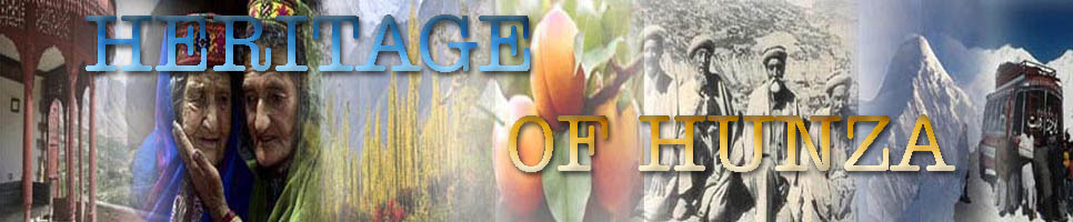
Hunza Valley is a mountainous valley in Gilgit in the Gilgit-Baltistan region of the Northern Areas of Pakistan. The Hunza valley is situated at an elevation of 2,438 metres (7,999 feet). The territory of Hunza is about 7,900 km² {3,050 mi²). Karimabad (formerly called Baltit) is the main town, which is also a very popular tourist destination because of the spectacular scenery of the surrounding mountains like Ultar Sar, Rakaposhi, Bojahagur Duanasir II, Ghenta Peak, Hunza Peak, Darmyani Peak and Bublimating (Ladyfinger Peak), all 6000 m (19,685 ft) or higher.

History

Hunza was formerly a princely state bordering China to the North-East and Pamir to its North-West, which continued to survive until 1974, when it was finally dissolved by Zulfiqar Ali Bhutto. The state bordered the Gilgit Agency to the south, the former princely state of Nagar to the east. The state capital was the town of Baltit (also known as Karimabad) and its old settlement is Ganish Village.

Hunza was an independent principality for more than 900 years. The British gained control of Hunza and the neighbouring valley of Nagar between 1889 and 1892 followed by a military engagement of severe intensity. The then Thom (Prince) Mir Safdar Ali Khan of Hunza fled to Kashghar in China and sought what can be called political asylum.

Hunza PeakHunza river The most authentic and dependable notables and the best of oral tradition narrator of Hunza, through generations, have narrated the tale of Alexander the Great. When he conquered all the cities and countries and brought them under his sway, he finally consolidated and established his court of justice. The hordes of the armies of the king were returning through this place (Hunza Valley) from the direction of China, While this army was passing through this valley, four persons of this force Shaano, Safar, Mamoo and Fulolo fell ill. On this the commander of this Army appointed and detailed the fifth person Mughal Titam as the caretaker of this small ill group. He was tasked to look after the remaining four persons until they all had recuperated from their diseases. He was ordered that once, by the grace of God, when they all were healthy and normal they were to make efforts to reclaim and settle this valley and make it irrigable and inhabitable.

After that every horseman and the foot soldier of the rest of the passing army was ordered to contribute a fistful of barley and flour as a contribution from each man respectively, as the rations for the sustenance of these five men, It is said that the amount of barley and flour collected in this manner had lasted for next three years as rations for this group of five men. After this stop over the rest of the army left this place and marched towards Gilgit. Once this army arrived at Gilgit a commander. named as Shah Raees, was detailed and appointed to reclaim and inhabit Gilgit valley. He managed to reclaim Gilgit valley and commenced to rule this valley, It is since this period /era that the family /clan of rulers of Gilgit have been named With the title of “Raeesay”.

Colours of Hunza RiverHowever the second version of this tale has been narrated thus; that when Sultan Sikander (King Alexander the great) conquered most of the countries of this side of the world and brought them under his reign, he turned towards his mother land with great pomp and show During this Journey back home when he reached the city of Babal (Babylone) he fell fatally sick. However,. before his death and while on his death bed. he equally allotted (apportioned and granted) his conquered lands among four of his trusted commanders of his army. Among them there was a commander by the name of Bakhtaria and he was the ruler of Tartaristan. After passage of a number of years this very military commander passed through this valley at the head of his army while returning from his campaign. The five above mentioned persons left behind at this place were from this army who had fallen sick and had reclaimed and inhabited this valley after they had fully recovered from their illness.

Yet another version of the "first settlers" of Hunza Valley is narrated by the ancient era oral tradition as follows: That a great revolution (of unspecified nature) occurred in the country of "Tartar" having its capital in a city called Takla Makan. This country was also known/called as "Bakhtaria" by some, and it was Inhabited by various clans and tribes; like Mughuls and Hunns. Because of the above mentioned great revaluation the people of this country were compelled and forced to flee in great numbers. it was during this large scale exodus and forced migration by the people of the Tartaristan/ Bakhtaria (Bactria) that a large group of these fleeing refugees comprising men, women and children along With their entire belongings and domestic animals passed through the present day valley to Hunza, which was during that era called and known as "Hari Yol" or "Ha Ha Yol, meaning the valley of happiness, and merry making. It was from amongst this passing group of fleeing refugees that one Mr. Mughal Titam of Mughal tribe was injured and temporarily disabled to walk as a result of his horse's kicking blows to his leg/thighs. He was therefore unable to proceed further and to undertake a long journey. Hence the leader/commander of the entire group of refugees detailed the four men, namely Messrs Safar, Shaano, Mamoo and Fulolo as the servants and caretakers of Mr. Mughal Titam and left them behind Rest of the migrating refugees group continued its march towards Gilgit Valley and on arrival reclaimed and inhabited this valley. Many of the refugees then dispersed into many other directions and Surrounding valleys.

Morning ColoursIn short; when Mr. Mughal Titam recuperated and recovered from his injury he and his four companions commenced their work to make this barren valley irrigable and inhabitable. Messrs Shaano, Safar and Mamoo remained in the company of Mughal Titam in Baltit and Mr. Fulolo made his abode in Ganish. It is said that Mughal Titam had a son by the name of Mughal Diram. This Mughal Diram had three sons, their names were; the first was Diram Pun, second Diram Budin, and the third was called Diram Muko. Following is the family tree of one of the first settlers of Hunza Valley.